Mount Bogong.
The highest peak in the state, it sits way up above the Kiewa Valley. Good old Mount Bogong. Thankfully there are no roads up the mountain. Its always a hard slog walking to get there, and with a wonderful other worldly feel when you’re up on the summit ridge, distant farmland and lower ranges far below.
The mountain is a big, arching ridge that folds around Cairn Creek on the south and faces back to the edge of the Bogong High Plains, and looms above the town of Mount Beauty. The big, south-facing gullies and slopes offer superb skiing, generally getting gnarlier and steeper as you head westwards. The northside is rockier and more impressive but tends to burn off more quickly. There is some good winter climbing near the top of Staircase Spur around the Pollux and Castor outcrops.Summer walking is wonderful, especially in wildflower season, around Christmas.
The walk in is hard no matter which way you do it, but its always worthwhile: a sense of remoteness, fantastic alpine country, silence, rock and sky, wonderful skiing.

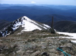
Almost at the top of the Staircase, looking back towards the memorial for Mick Hull, Howard Michell and Cleve Cole, who died on the mountain in 1936
This impressive mountain towers above the Valley of the Kiewa River and was of great significance to local traditional owner groups. As noted by Parks Victoria, “Many Aboriginal people have a remarkably rich history of Aboriginal use in the Victorian Alps and a vast knowledge of the cultural sites, oral history and ancestral stories that relate to the alpine region of Victoria. Throughout the many seasons each year, Aboriginal groups would come from as far away as the coast and south west slopes, to meet with the tribes of the mountains for intertribal ceremonies and feasting on Bogong Moths. During these festivities they would exchange cultural objects and materials for tools”.
In the Waywurru and Dhudhuroa languages, the mountain is named Warkwoolowler, meaning the mountain where Aboriginal people collected the Bogong Moths. (source).
According to Indigenous historian Eddie Kneebone, “the Yiatmathong (people) controlled the Kiewa and Mitta Mitta Valleys, they also had control of the Alpine region on the Victorian side. Their southern most boundary extended to Hotham and ran along the highest ridge line of the Alps in an east-west direction. Because Mt Bogong fell within the Yiatmathong territory, permission had to be gained from them by the other tribes participating in the summer feast. Once this was done, the tribes would spend summer in the cooler climate of the mountains feasting on the protein rich Bogong moth”.(‘[1]‘,)
According to Kneebone, prior to climbing Mount Bogong and the Bogong High Plains, the tribes would gather by the Murray River at Mungabarreena (near modern Albury). After ceremonies, initiations, marriages, trading, settling of disputes, and renewing of alliances and friendships, the groups would walk from Albury to the mountain region to feed on the protein-rich Bogong Moths [2].
Following European settlement, Indigenous groups were decimated and survivors were placed onto settlements, often far from the traditional lands. Indigenous visitation to Mount Bogong is generally understood to have finished by the mid 19th century. While there was cattle grazing for some time, it was the walkers and then skiers who became the next group to visit the mountain in large numbers.
More images here.

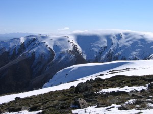
the southern face of Bogong, looking across Cairn Gully

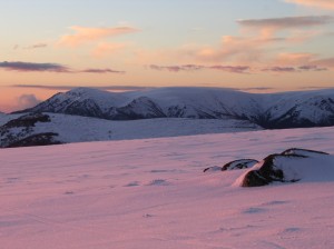
South side of Bogong, from the High Plains


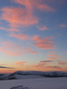
Mt Bogong, across the High Plains
i love the mountain ranges that we have