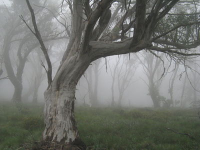
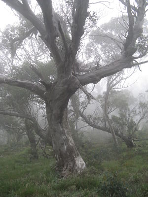
Mount Wills is an extension of the Long Ridge that comes off the eastern side of Mount Bogong. It is a place that lends itself to solitude and contemplation. The summit area is a broad ridge that drops away into gentle folds of gullies, covered in open Snow Gum woodland, with big old trees scattered amongst the grasses and flowers, all in a giant garden of granite boulders and outcrops. Although the shortest way in, via a 2WD track off the Omeo highway to the Tallangatta ski club, is a mere 3 kilometres, it is often a quiet place. From the summit area, which is ringed by a broken cliff-line and steep slopes on the east, there are fantastic views in all directions, across the Wombat catchment and as far as the Main Range of the Snowies.
Low down the ash forests were badly burnt in the fires of 2003 and impacted by the subsequent salvage logging, but the fire damage is patchy across the mountain, and there are still wonderful pockets of older trees. As you climb further into the snow gum zone there are many areas of dead parent trees but also wonderful and widespread zones of old and gnarly elder trees. You often seem to get mist up here and it can be incredibly evocative to wander up the mountain as big old trees and granite boulders loom into view.
There is a fairly ugly but eminently comfortable cabin on the summit, with 2 sleeping rooms, a pot belly stove and lounge room, and wonderful views, just metres from the cliff line. And lots of flat(ish) platforms on the nearby rocky outcrops to camp on. Silence and mist and distant views are the order of the day. The mountain sits on the alpine walking track (AWT), which continues southwards for a while, following the ridge to Wills South, which was more badly burnt and is now very patchy and scrubby, before dropping steeply and entering lower forested country.
On the western side the views are up to the eastern fall of the Bogong High Plains and Bogong itself. It is not a big skiing destination, although there can be some wonderful runs off the eastern side of the summit when its in condition and some nice forrays out towards Bogong and then back north eastwards to the ski club site after a big fall. It is also a short walk in from the highway, with a longish drive in from either north or south, so its not a big weekend walking destination unless you live somewhere like Albury or Wodonga. Many of the people you are likely to meet there are on a longer journey along the AWT. Which is great for finding that elusive silence.
I am not sure whose country it is, I had assumed Murray Valley tribes. I only have 2nd and 3rd hand stories of the place – mostly these refer to the theory that it is a men’s place. Also that the quartz you find here, including a red quartz, was valued in healing and had other magical properties and was traded way out west, past the Kulin lands. It would also have been a logical destination for people from the south – from the Omeo plains and the Mitta Mitta. There are old camps along the Cobungra and other rivers that were base camps before people headed into the high country in spring and it would have been possible to follow the Big River upstream from the camps, launching up onto the ridge line that eventually peaks in Mt Wills.
Regional historian Peter Gardner puts Mount Wills in Jaithmathang country, although notes that Upper Murray tribes, who had a friendly agreement about access to the higher peaks during the Bogong Moth season, also traveled to these ranges. He quotes early settler sources (via Josephine Flood) as saying that in the preparation for moth season, up to 1,000 people were seen along the upper reaches of the Mitta Mitta river, waiting to go into the higher mountains. “These figures indicate a seasonal movement of associated tribes and allies into Jaithmathang territory”.
There is also an intensive European history, with big towns both down at Glenn Wills and also up at Sunnyside on the eastern flanks of the mountain. It would have been one of the higher settlements in the state during the 19th century. Its hard to tell now, but there was substantial exploration and mining even up above 5,000 feet on the summit ridge and waterways were cut to channel water. But now days, with a casual glance, it just seems wild and remote, a great place to hunker down and spend some quiet time.
There is skiing info available here.


